The Road from Batalik to Leh: Through Ladakh’s Colourful Stone Mountains
Some journeys are remembered for their destination. Others remain with you because of the road itself. Our drive from Batalik to Leh belonged firmly to the second category. This remote route took us through the Brokpa villages of Garkon, Darchik, Dha and Hanu before following the Indus towards Khalsi, where we joined the main Srinagar–Leh highway. From there, we continued through Saspol, Basgo and Nimmu before finally reaching Leh. The distance from Batalik to Leh is approximately 200–215 kilometres, depending on the precise starting point and any village detours. Although this may not sound particularly far, the journey generally requires around six to eight hours of driving without lengthy stops. With photography breaks, checkpoint formalities, and time spent admiring the landscape, it is best treated as a full-day road trip. This was one of the most spectacular stretches of our 21-day offbeat Ladakh itinerary.
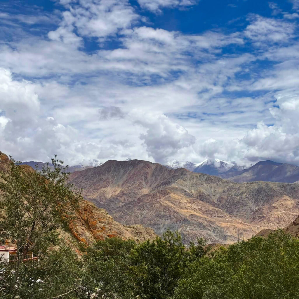
Batalik to Leh route at a glance
Route: Batalik–Garkon–Darchik–Dha–Hanu–Achinathang–Skurbuchan–Khalsi–Saspol–Basgo–Nimmu–Leh
Approximate distance: 200–215 kilometres
Driving time: Approximately 6–8 hours without extended stops
Recommended travel time: One full day
Road conditions: A mixture of paved mountain road, narrow single-lane sections, occasional broken surfaces and a wider, smoother highway after Khalsi
Main scenery: Indus River gorges, Brokpa villages, apricot orchards, rocky canyons and extraordinarily colourful stone mountains
Distances and journey times can vary according to the exact starting point, roadworks, weather, military checks and the number of stops made along the way.
From Kargil into the Batalik region
Before reaching Batalik, we had travelled through Kargil, a town whose cultural character was quite different from anything I had expected. Walking around Kargil, we noticed posters of Ayatollah Ruhollah Khomeini—and also Ayatollah Ali Khamenei, I think—in shops and other public spaces. I must admit that they looked remarkably similar to me, so I was not always sure which one I was seeing. I would never have guessed that two Iranian religious leaders would have such a visible presence in this small Himalayan town in India, and it brought back a blast of memories from my Iran trips. Kargil, however, has a predominantly Shia Muslim population and maintains longstanding religious and cultural links with Iran. These connections have developed through religious scholars, education, pilgrimage routes, and wider cultural exchanges. It was one of those unexpected reminders that even a seemingly remote Himalayan town is connected to a much larger global world.
Interestingly, Khomeini’s family also had historical connections with India, although his ancestors were associated with northern India rather than Kargil. The relationship between Kargil and Iran is complex and fascinating, and it is something I would like to read more about. The culture of Kargil district and this article on Ladakh’s connection with Iran provide interesting introductions to the subject. From Kargil, our journey led us into the sensitive Batalik sector and then through the Brokpa villages towards Leh. The religious and cultural character of the landscape continued to change along the way—first through the predominantly Shia areas around Kargil and Batalik, then through the distinctive Brokpa settlements, and finally towards the more visibly Tibetan Buddhist surroundings of central Ladakh.
Leaving Batalik
Batalik is not a conventional tourist destination. It lies in a strategically sensitive border region that played an important role during the 1999 Kargil War. Military camps, checkpoints, and restricted installations remain part of the landscape. The road leaving Batalik was quiet, narrow and surrounded by immense walls of rock. Traffic was scarce, settlements were widely scattered, and there were few places to stop for food or fuel. Except for occasional military convoys, a sense of remoteness was immediate. Photography is prohibited around military camps, checkpoints, and other sensitive infrastructure. Travellers should keep cameras and mobile phones safely stored whenever soldiers or military installations are visible.
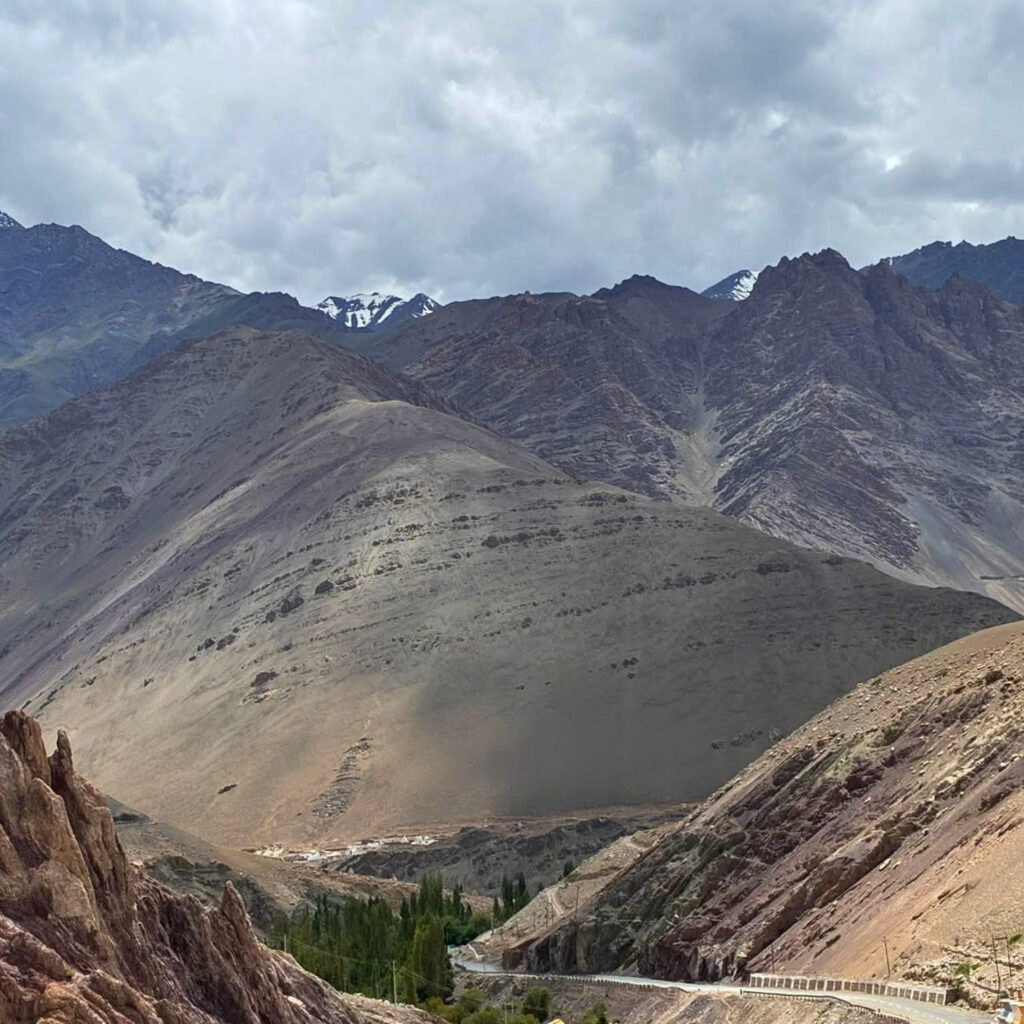
Through the Brokpa villages
From Batalik, the road passed through the isolated Brokpa region, popularly known as Ladakh’s “Aryan Valley”. Garkon and Darchik were followed by the settlements around Dha, Hanu, Achinathang and Skurbuchan. The villages appeared as unexpected pockets of green in an otherwise severe landscape. Apricot trees, poplars, vegetable gardens and terraced fields surrounded traditional houses, creating an extraordinary contrast with the barren mountains. We were in the apricot country, and there were apricot trees everywhere. Trees bore heavy loads of the sweetest apricots I have ever tasted. These fruits were scattered on the road, crushed under the tires of the passing vehicles, drying on sheets in the sun, being squeezed to make the precious apricot oil, or simply rotting in roadside gutters. In fact, during one military stop, we got out of our car to stretch our legs and eat apricots plucked straight from the trees growing along the road. This region lies at a lower altitude than Leh and has a comparatively warm microclimate. Apricots, walnuts, apples, grapes, barley, millet and buckwheat can be grown here. During summer, the trees provide welcome shade and soften the harshness of the surrounding terrain. The villages themselves remained quiet and deeply agricultural. Narrow paths wound between stone and wooden houses, irrigation channels carried mountain water through the fields, and fruit trees leaned over courtyard walls. There was little of the tourism infrastructure found in other parts of Ladakh.
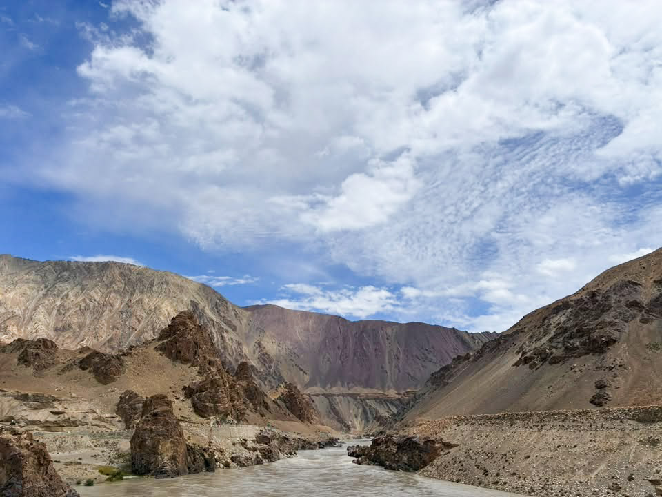
Batalik to Leh road runs along the Indus
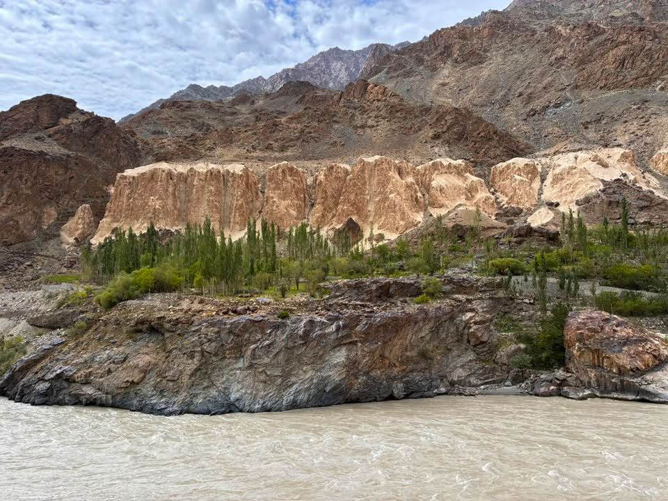
For much of the journey, the Indus River was our constant companion. Sometimes it flowed immediately beside the road; at other points, it disappeared below steep rock walls before reappearing around the next bend. Here, the Indus did not always resemble the broad, calm river seen closer to Leh. Its muddy, powerful water was squeezed between narrow gorges and flanked by eroded cliffs. The road repeatedly climbed above it and then descended towards isolated villages along its banks. The landscape felt raw and unfinished. Loose rock covered the slopes, dry gullies cut through the mountains, and the road seemed almost too fragile for the scale of the terrain surrounding it.
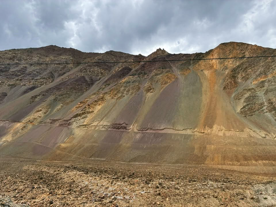
Ladakh’s beautiful, colourful stone mountains
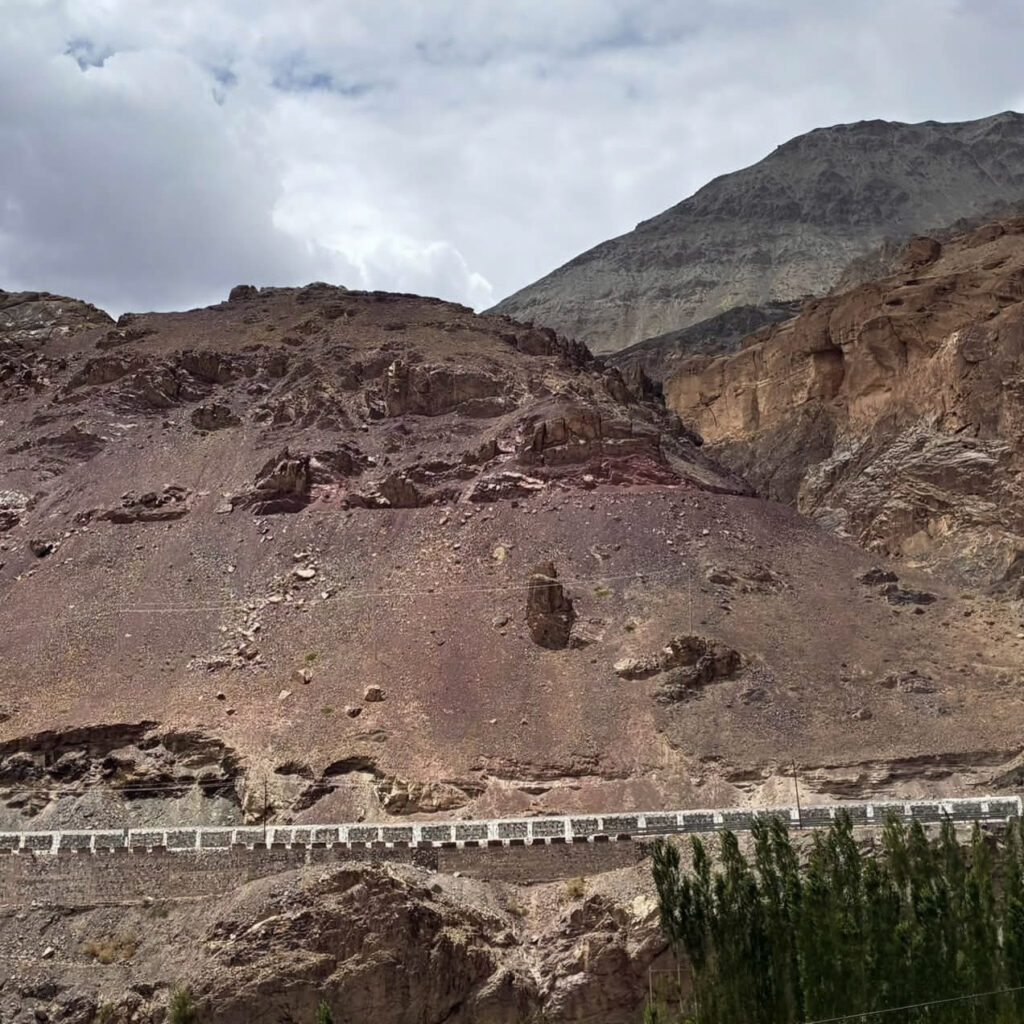
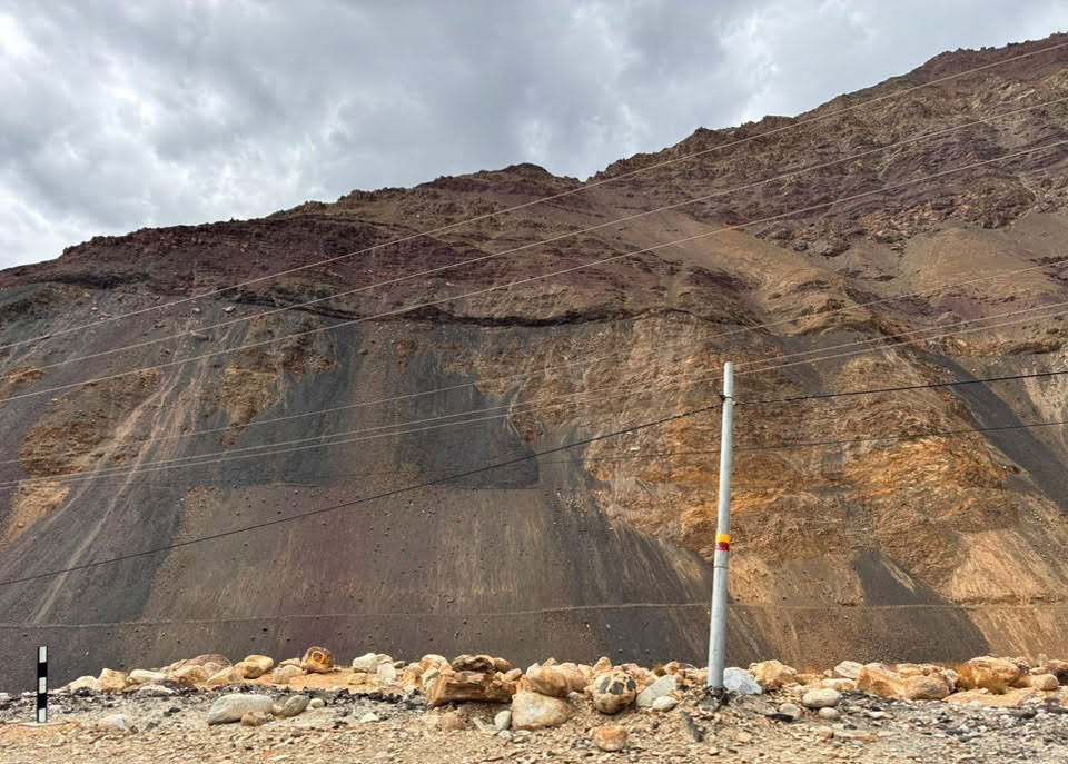
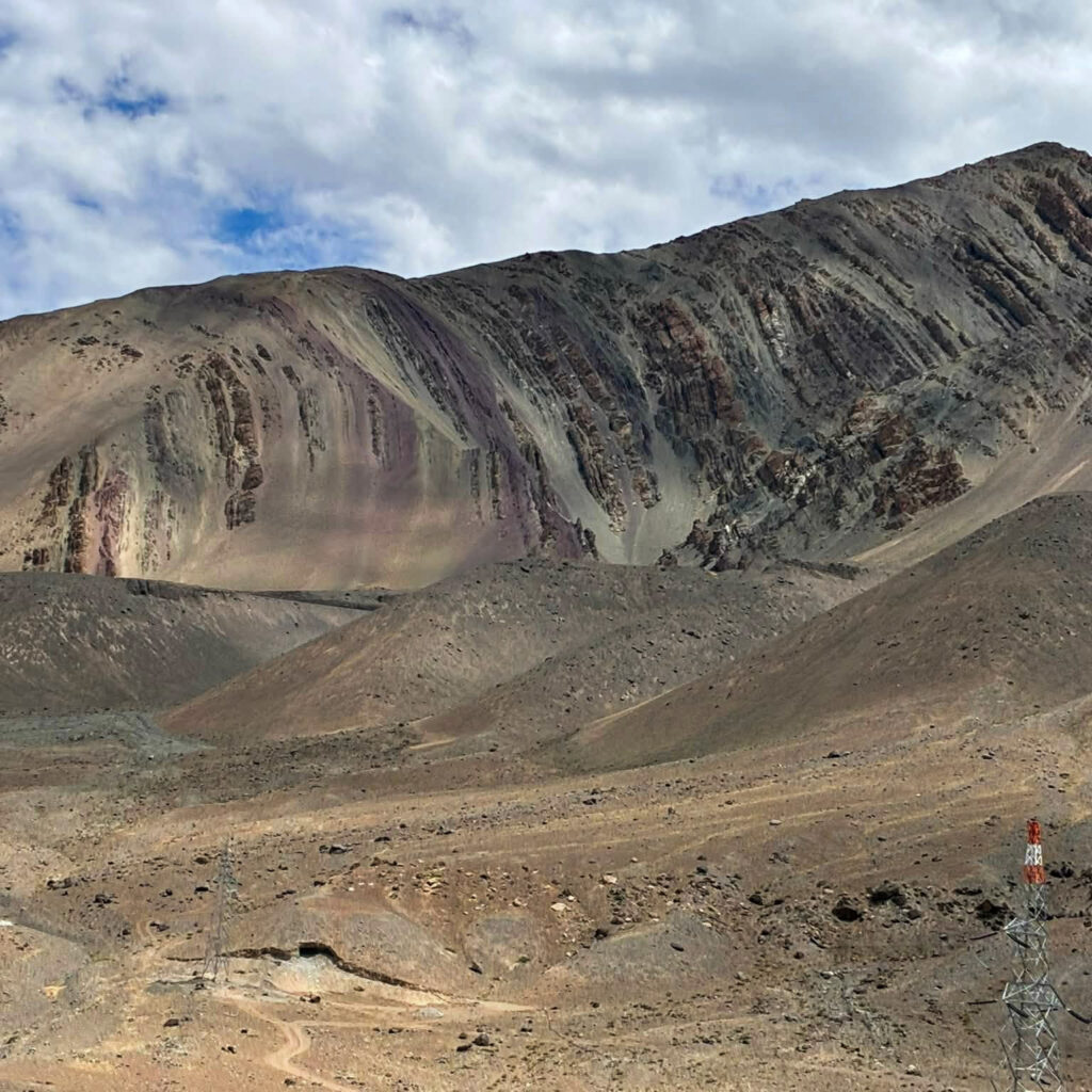
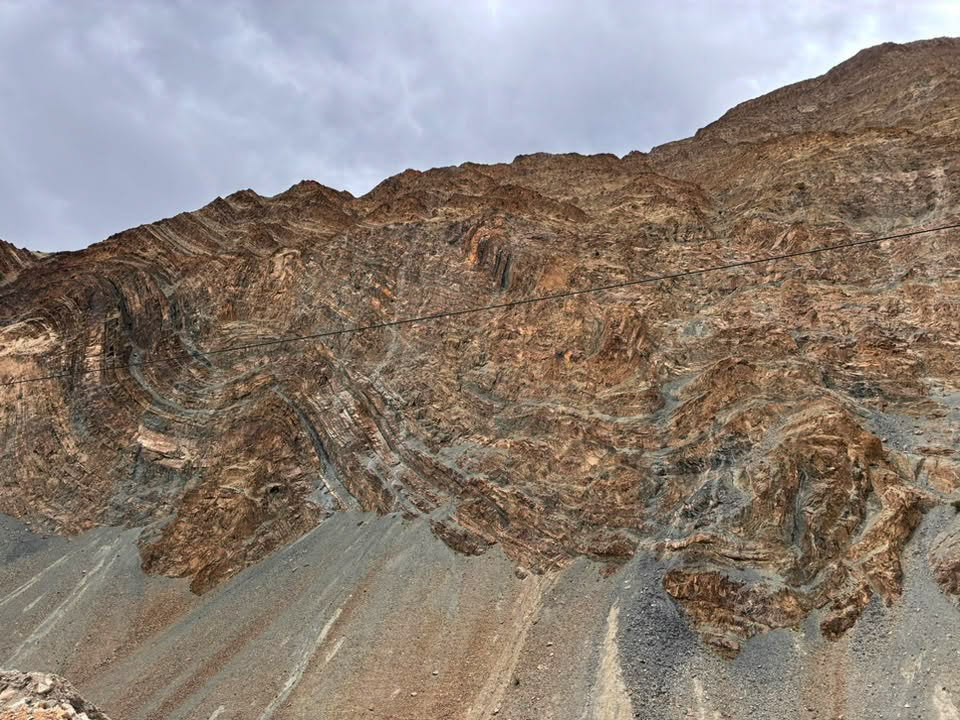
If I had to choose one feature of Ladakh that amazes me every time I am there, it´s the region´s incredibly colourful mountains. They were not uniformly grey or brown. Instead, entire slopes appeared to have been painted in layers of rust, ochre, copper, violet, charcoal, olive green and slate. Some mountains were folded into dramatic diagonal bands. Others had long streaks of orange and yellow running down their faces. In places, deep red and purple rocks rose beside pale gravel slopes, while patches of green-grey stone created patterns that looked almost artificial. There was very little vegetation to conceal their geological structure. Every fold, fracture and sedimentary layer remained exposed. The absence of trees made the mountains appear even larger, older and more intensely coloured. Clouds moved quickly across the sky, continually altering the light. A slope that looked dark and forbidding one moment could turn copper-coloured when the sun broke through. Every bend revealed another combination of colours, textures and geological formations. It was difficult to stop photographing them.
A landscape shaped by water
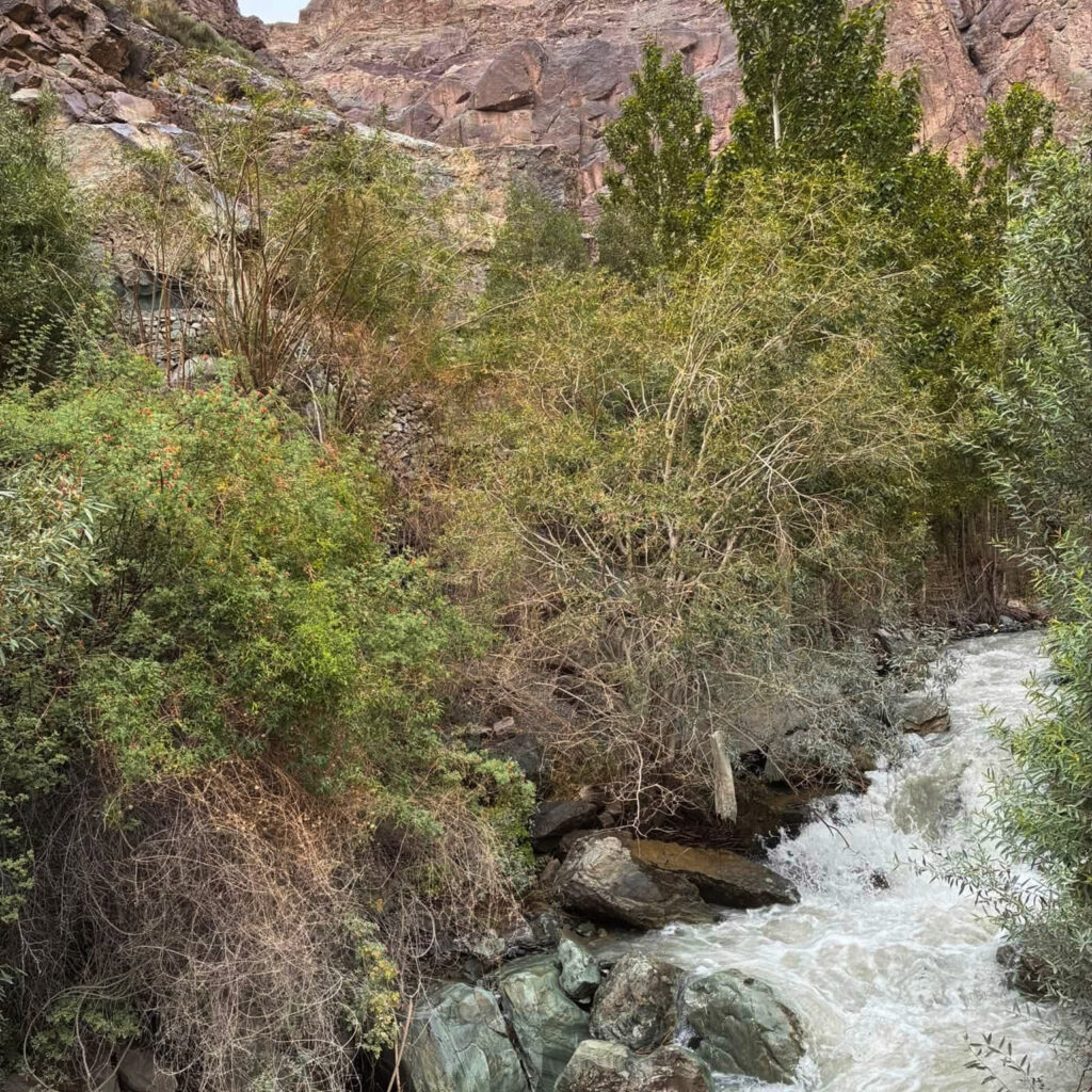
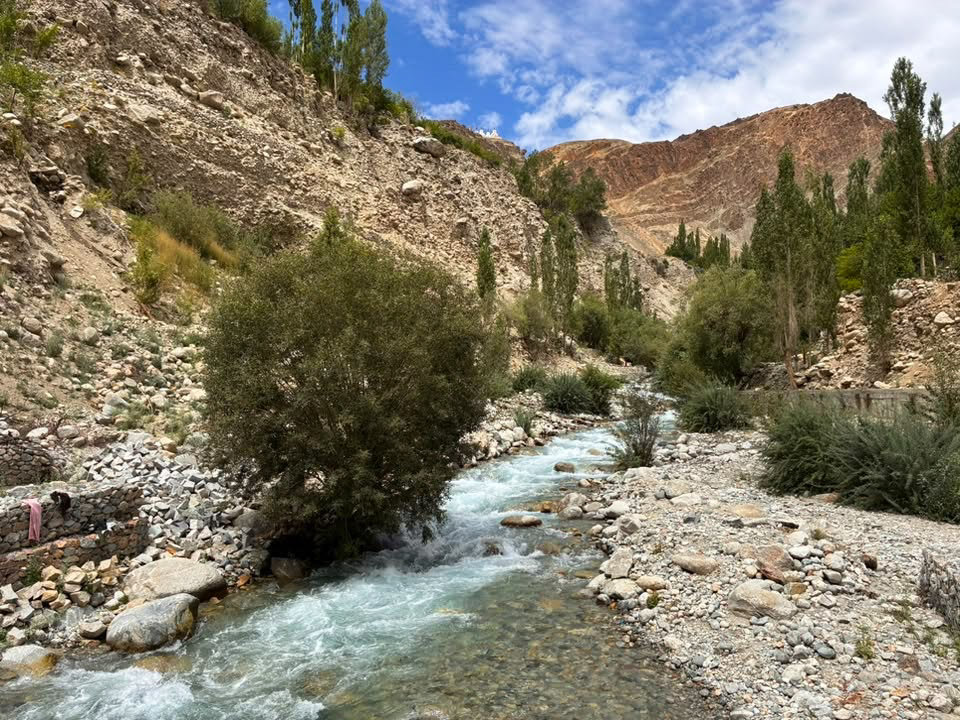
The rivers and streams created startling contrasts throughout the journey. Pale blue mountain water rushed through narrow channels surrounded by grey stones, while willows and poplars crowded along the banks. These ribbons of water supported the orchards and fields of the villages. Without them, there would have been little greenery in this otherwise dry, high-altitude landscape. The colour of the water also changed along the route. Some streams were clear and blue, while the Indus carried a heavier load of glacial silt and appeared brown or grey. Wherever two watercourses met, the surrounding rock formations seemed to become even more dramatic.
Road conditions between Batalik and Khalsi
The road between Batalik and Khalsi was generally driveable but demanded concentration. Much of it was paved, although it frequently narrowed to a single lane. There were tight bends, blind corners, uneven edges, and occasional gravel or damaged sections. In places, the road clung closely to the mountainside, with steep drops towards the river. Loose stones and signs of minor rockfall were visible along parts of the route. Heavy rain can trigger landslides or cause stones to fall onto the road, while winter snow may temporarily cut off sections of the region. The lack of traffic contributed to the feeling of isolation, but it also created a potential danger. On an apparently empty road, a vehicle could suddenly appear around a blind bend. Army trucks and local vehicles also use the route, so drivers need to remain alert. Road repairs are common in Ladakh, and conditions can change quickly. A smooth section may be followed by construction work, broken asphalt or loose gravel. Travelling with an experienced local driver made this remote journey considerably less stressful.
Small settlements beneath immense mountains
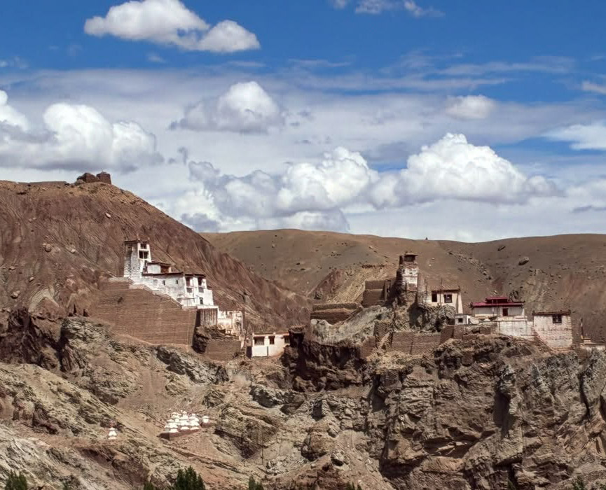
Human settlements looked almost impossibly small against the surrounding landscape. Houses were built on rocky outcrops, beside patches of cultivable land or beneath cliffs that seemed to tower directly over them. Whitewashed buildings and religious structures stood out clearly against the earth-coloured slopes. Poplar trees marked the presence of water, while cultivated terraces revealed how carefully local communities use every fertile section of the valley. These settlements did not seem to interrupt the landscape. Instead, they appeared to have been absorbed into it.
Rejoining the Srinagar–Leh highway at Khalsi
Khalsi marked a clear transition. After hours on the narrow and isolated road through the Aryan Valley, we joined the main Srinagar–Leh highway. The difference was immediately noticeable. The road became wider, smoother and faster. Traffic increased, settlements appeared more frequently, and small restaurants, shops, fuel stations and other roadside facilities gradually returned. From Khalsi, we travelled directly towards Leh, passing through Saspol, Basgo and Nimmu. Although the journey became easier, the scenery remained spectacular. The Indus continued beside us, while the mountains displayed extraordinary bands of ochre, copper, violet, grey and green. After the isolated Batalik road, even the modest amount of development along this section felt surprisingly busy.
Basgo’s ancient landscape
One of the most distinctive sights on the final approach to Leh was Basgo. Its old fortress and monastery buildings appeared above a deeply eroded landscape of rock and clay. The structures blended so completely with the mountains that they were easy to overlook at first. Their white walls and dark windows emerged from a maze of crumbling ridges, giving the entire scene an ancient and almost otherworldly appearance. After the empty valleys and colourful geological formations of the Batalik route, Basgo felt like a natural continuation of the landscape rather than a monument standing apart from it.
Nimmu and the final approach to Leh
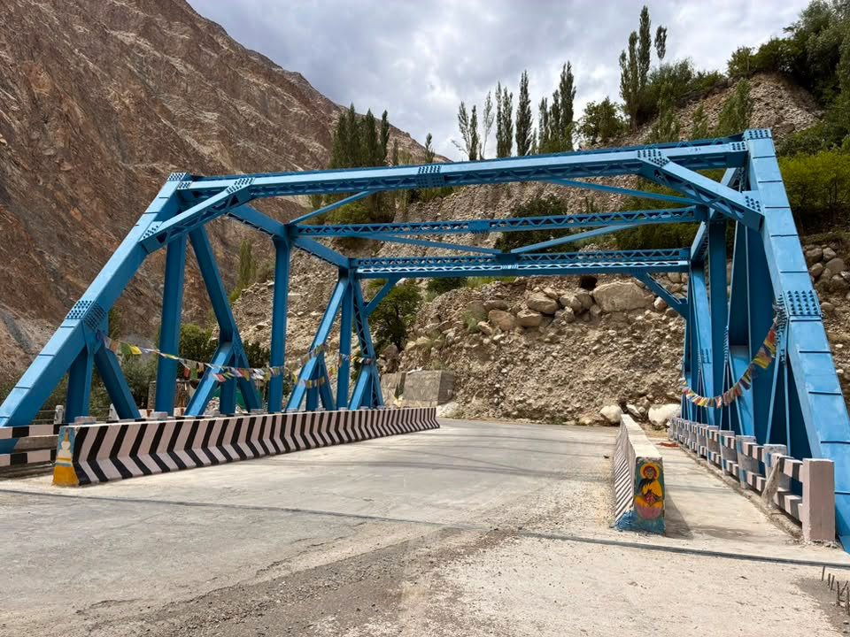
At Nimmu, the Zanskar River meets the Indus, and the road enters a more frequently travelled part of Ladakh. Traffic grew heavier, villages became larger, and the surroundings gradually felt less remote. The final drive into Leh was comparatively easy. The road was broad and well surfaced, and the complete isolation of Batalik already seemed far away. Leh felt almost metropolitan after the Brokpa villages and empty river gorges. Shops, hotels, restaurants and busy streets replaced the lonely roads we had followed for most of the day. Yet it was the Batalik route that remained most vivid in our minds: the narrow road beside the Indus, small bridges, green orchards, isolated settlements and those astonishing stone mountains coloured with copper, violet, ochre, grey and rust.
Practical tips for the Batalik–Leh drive
This journey passes through a sensitive border region. Permit and access requirements can change, particularly for foreign nationals, so the current regulations should be confirmed in Kargil or Leh before travelling. Carry your passport, visa, permits and several photocopies. Do not photograph soldiers, military camps, checkpoints, bridges or sensitive infrastructure. Fuel and food options are limited between Batalik and Khalsi. Begin the journey with a full tank and carry drinking water, snacks, warm clothing and essential medication. Mobile coverage can be unreliable in the more remote sections. Allow considerably more time than an online map might suggest. Even when the road is open, checkpoints, construction work, rockfalls, slow village sections and photography stops can extend the journey. It is safest to leave early and avoid driving the narrowest portions after dark. A private vehicle with a knowledgeable local driver is the most practical and comfortable way to complete the route.
One of Ladakh’s most beautiful road trips
The journey from Batalik to Leh was not simply a transfer between two places. It carried us through one of Ladakh’s least-known landscapes—a region shaped by borders, rivers, erosion, isolation, and the persistent efforts of mountain communities. The first part of the drive felt wild and extraordinarily remote. There were no famous attractions to tick off and few established viewpoints. Instead, the road offered apricot orchards glowing beneath barren mountains, tiny settlements hidden above the river, narrow bridges, near-empty roads and an overwhelming sense of space. Most unforgettable of all were the colourful stone mountains. Their purple, copper, green, rust and ochre layers transformed continuously under the changing light. They made the entire journey feel like a drive through the exposed geological history of the Himalayas.
Our Batalik-to-Leh drive formed part of a longer journey covering Delhi, Srinagar, Sonmarg, Mushkoh Valley, Garkon, Leh and Nubra Valley. This trip was planned and organised by my friend Shuib Kaw of Versatile Adventure Holidays. He is available at +91 76783 57621 or [email protected]. I paid for this trip myself, and if I am promoting Versatile Adventure Holidays, it is because they did a great job organising our journey through some of the remotest parts of Ladakh. You can read more about the complete journey in my post, An offbeat Ladakh trip with Versatile Adventure Holidays.
Follow the Ladakh series
- AN OFFBEAT LADAKH TRIP
- KASHMIR TO KARGIL ON SRINAGAR LEH ROAD
- KARGIL TO LEH
- LEH (ED) IN LADAKH
- MOUNTAINS AND MONASTERIES
- THE LADAKH FESTIVAL
- THE BEAUTIFUL BLUE PANGONG LAKE
- THE WHITE DESERT AT NUBRA VALLEY
- 2012 LADAKH ITINERARY AND TRIP COSTS
- OFFBEAT LADAKH ITINERARY 2026
- MUSHKOH VALLEY TO BATALIK ROAD TRIP
- HIMALAYAN BEAR HABITAT OF MUSHKOH VALLEY
RESPONSIBLE TRAVELING-BECAUSE I CARE

